
Your data should hold up in a board meeting, a compliance audit, and a dispute. Skymetix builds every survey so it can.
Accurate reality capture for agriculture and mining operations that need clarity, consistency, and confidence on the ground.
Most drone survey companies deliver a file and move on. You get accurate data on the day, but three months later, when your mine engineer needs to reconcile volumes or your agronomist wants to compare field health across seasons, you have a dataset with no clear lineage, no consistent reference point, and no way to tell whether the change you are seeing is real or a product of how the survey was run.
Misjudged stockpile volumes. Failed compliance submissions. Rework on data you have already paid for. Time spent explaining inconsistencies instead of acting on the numbers. The gap between a snapshot and a reliable record has real consequences.
Skymetix builds a structured capture methodology for your specific site from the first engagement. Ground control is documented. Flight parameters are locked. Processing pipelines are standardised. Each return visit aligns precisely with the previous one, because both were captured and processed to the same documented standard.
Over time, you do not just have survey data. You have a growing, comparable, dispute-resolution-grade digital record of your land or site, structured to hold up in any report, audit, or legal proceeding.
Your data should hold up in a board meeting, a compliance audit, and a dispute. Skymetix builds every survey so it can.
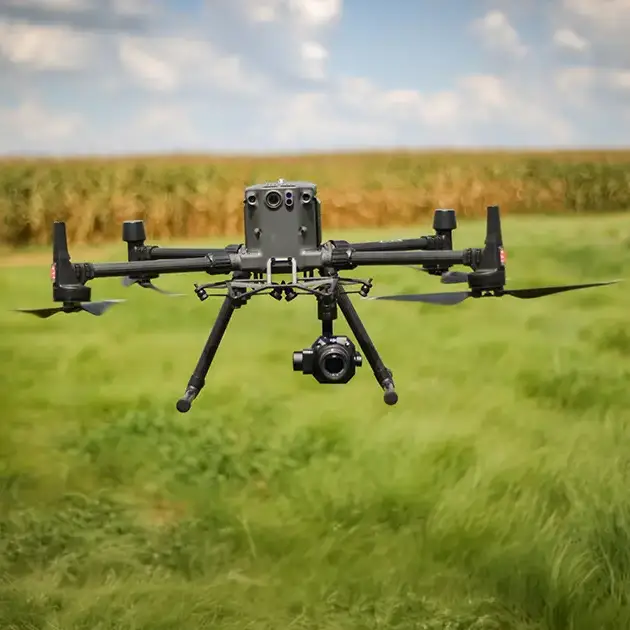
The RTK aerial platform flies to a consistent, documented flight plan. Ground control points are established and archived. Every parameter affecting data alignment is locked with the survey record from day one.
You know exactly how your data was captured, every time.
Standardised processing pipelines give every output dataset the same coordinate reference system, resolution, and classification scheme. The method does not change between engagements. That is what makes the data comparable.
The numbers align because the method aligned first.
Deliverables arrive in formats your GIS, BIM, and reporting tools can use immediately, accompanied by capture parameters, GCP coordinates, accuracy reports, and processing lineage notes. Take it straight to your engineer or compliance team.
Ready to submit, share, or store. First time, every time.

Skymetix Agri builds a growing aerial record of your agricultural operation. Each engagement adds to what came before, giving you seasonal comparison, year-on-year crop health trends, and drainage analysis you can act on with confidence.
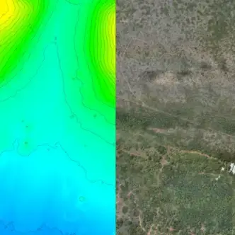

Skymetix Reality delivers the spatial intelligence mining and industrial operations need to manage volumes, monitor progress, and satisfy compliance requirements, structured so the data speaks for itself.
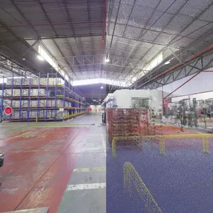
Output formats you can use directly
GeoTIFF, LAS, LAZ, DXF, SHP, IFC, RVT, DWG, PDF, CSV. Compatible with ArcGIS, QGIS, AutoCAD Civil 3D, Revit, Trimble, and Leica.
Every credential, every specification, and every process standard Skymetix operates under exists for one reason: so you never have to explain the data to a regulator, engineer, or board member.
Skymetix delivers standard industry formats including GeoTIFF orthomosaics, LAS and LAZ point clouds, DXF and SHP contour and vector files, IFC and RVT for BIM integration, and PDF and CSV volumetric reports. These are directly compatible with ArcGIS, QGIS, AutoCAD Civil 3D, Revit, Trimble, and Leica reporting environments. If your team uses a specific platform, confirm it during the initial brief and Skymetix will verify compatibility before mobilisation so there are no surprises on delivery day.
Using an industrial-grade RTK aerial platform with full-frame photogrammetry sensors and established ground control points, Skymetix achieves sub-5cm positional accuracy on deliverables. Every volumetric report includes documented accuracy metadata, GCP coordinates, and processing lineage, structured for compliance submission and audit. Stockpile volumes produced by this methodology have been submitted directly to compliance teams without requiring re-survey or additional verification.
Consistency is built into the methodology from the first capture. Ground control points are established and documented for each site, flight parameters are recorded and replicated on every return visit, and processing pipelines are standardised to the same coordinate reference system and resolution each time. A stockpile volume calculated in March can be directly compared against the October capture without re-calibration or reprocessing. The site builds a structured digital record with each engagement, not an isolated file.
Standard deliverable turnaround is 3 to 5 business days from capture, depending on site complexity and the number of output types required. Urgent processing can be arranged. Skymetix confirms expected delivery timelines before mobilisation so your team can plan around them. Time-critical compliance submissions or scheduled reporting windows can be accommodated with advance notice.
Yes. Skymetix operates under SACAA UASOC number CAA/G1430D, the South African Civil Aviation Authority's certification for unmanned aircraft system operators. This means Skymetix meets the legal requirements to operate commercially in South African airspace, carries appropriate indemnity, and operates under a defined safety management framework. For your operation, this means the survey is legally conducted, the operator is accountable, and the data carries the credibility of a regulated process, relevant for compliance submissions and any dispute requiring documented methodology.
Yes. Skymetix is structured for site-ready deployment on remote and restricted-access properties. The team operates its own industrial-grade RTK aerial platform and does not rely on third-party operators or logistics. For mine sites with specific induction and safety requirements, Skymetix coordinates site access, safety documentation, and airspace notifications before mobilisation so the capture day proceeds without administrative delay on your end.
The first conversation covers your site, what you need from the data, any existing survey data or GIS coordinate systems already in use, and your reporting or compliance timelines. From there, Skymetix proposes a capture plan, confirms deliverable formats, and establishes ground control methodology. On the day itself, your team provides site access and any induction requirements. No technical preparation is needed on your side. The briefing process is designed to take less than an hour and result in a clear capture plan you can approve before mobilisation.
Both. Skymetix can conduct a once-off survey for a specific compliance submission, a design project, or an operational need. However, the methodology is always structured from day one to support a repeat programme if you choose one. Ground control is documented, parameters are recorded, and processing is standardised, so even a single survey can serve as the baseline of a longitudinal record if your needs expand. You are not locked into a programme, but you are always positioned to start one.
For large, complex, or difficult-to-access areas, aerial survey typically reduces capture time significantly compared to ground-based methods while delivering comparable or higher spatial density of data. Stockpile volumetrics that would require days of ground-based measurement can often be captured in hours aerially. The long-term cost advantage compounds with repeat surveys because the methodology is pre-established: each return engagement requires less setup and delivers a directly comparable dataset without additional calibration overhead. The value of consistency over time is generally not available from traditional one-off ground methods at all.